fbpx

by:

posted in: Energy

April 26, 2024

TRCP Breaks Down Updates to BLM’s Oil and Gas Leasing Policies  

The Bureau of Land Management has modernized its rules regarding oil and gas leasing on public land to reduce conflict between oil and gas development and fish, wildlife resources  

Sportsmen and sportswomen have been promoting responsible land use and energy development for decades. Our community spends a lot of time exploring public lands, and at some point we all experience how energy development can impact our favorite time-honored traditions, recreational pursuits, and the fish and wildlife populations we love. 

This is why we’re pleased that the Bureau of Land Management has modernized national onshore oil and gas leasing regulations to help reduce the conflict between oil and gas development and other important multiple uses, including hunting, fishing, and wildlife habitat. Some of these updated rules come directly from the Inflation Reduction Act passed by Congress in 2022 and are required to allow BLM staff to implement that new law. Many of BLM’s rules governing oil and gas leasing on public lands were over fifty years old; these new rules are more up to speed with modern day science and technological advancements, resource needs, and state and federal guidance. That is just good policy.  

Below are a few specific provisions from the updated rules that will help conserve your hunting and fishing opportunities and cultural resources where oil and gas development occurs: 

Updated bonding requirements. When for-profit entities develop public lands, the government should ensure that those entities can cover associated clean-up costs in the future to protect public land users and landscapes. One way to do this is to require bond money at the beginning of a project lifecycle. Oil and gas infrastructure, operations, ongoing maintenance, and reclamation have all become more costly since the existing bond rate was set in 1960, therefore the updated rule increases the minimum lease bond amount for developers/operators from $10,000 to $150,000, and the minimum statewide bond to $500,000. This will reduce the number of abandoned wells that taxpayers must foot the bill to clean up, which helps public land that’s no longer in production go back to providing us all with room to roam. 

Prioritization for leasing outside of important wildlife and cultural areas. The updated rule will help steer oil and gas leasing and development away from important wildlife habitats, such as migration corridors, and cultural sites, and toward lands with existing infrastructure or high production potential. 

Increased royalty rates. Because BLM’s leasing and development regulations allow for-profit entities to generate revenue from producing public assets (including oil, gas, and other hydrocarbons and minerals) on federal public land, a small portion of that revenue is paid back to the public agency through royalty payments. Under the new rules, royalty rates for leases will increase.  For leases issued during the 10 years after the effective date of the Inflation Reduction Act the royalty rate will be 16.67 percent (up from 12.5 percent), and after August 16, 2032, the rate of 16.67 percent will become the minimum. 

Increased minimum bid requirements. BLM oil and gas lease auctions have a minimum bid amount established to ensure that public lands and minerals maintain a minimum base value across the country. The BLM’s updated rules, per the Inflation Reduction Act, will increase the national minimum bid from $2 per acre to $10 per acre. A higher minimum bid rate will help ensure that only lands with high development potential are leased at auction and that the public lands we all value so much aren’t sold for pennies. 

Minimum rental rates per acre. Normally, lessees can hold on to federal onshore oil and gas leases for ten-year terms. The BLM’s new rules, per the Inflation Reduction Act, include a rental fee of $3 per acre per year during the first 2-year period of the lease term; a $5 per acre per year for the following 6 years; and then $15 per acre per year thereafter. After August 16, 2032, those rental rates will become minimums and could be increased. This creates a financial incentive for developers to release leases if they have no intention of developing them.   

Expression of interest fee. BLM staff assess all parcels for which there are ‘expressions of interest’ in leasing, and companies or individuals can propose lists of parcels whether they fully intend to bid on them during lease auctions or not. By adding a fee of $5 per acre, or a fraction thereof, for filing expressions of interest, the BLM will encourage speculators to submit expressions of interest for parcels for which there is genuine interest and value, which will likely reduce administrative burden on BLM staff as well. 

The case for updating BLM oil and gas leasing policies 

We all use significant amounts of energy to power our day-to-day activities and to get us to our favorite hunting and fishing spots, so ensuring that energy is developed responsibly is critical to maintaining our way of life.  

The 2024 Colorado College Conservation in the West Poll found that ninety percent of Western voters believe that oil and gas companies should pay to clean up their messes – a burden taxpayers have shouldered for too long. Also, sixty-three percent of Western voters believe drilling should only occur on land with the highest likelihood of producing oil and gas. The new oil and gas rule addresses both of these concerns by steering leasing away from land with little potential for drilling, and raising bonding rates to limit future abandoned and orphaned wells.  

The TRCP supports updating federal rules to facilitate low-impact and high-return energy development (including but not limited to oil and gas development) when and where it is appropriate according to the best data, science, and policy.  

These updates are not anticipated to impact domestic energy production but will ensure taxpayers receive a better rate of return on that development, and fewer impacts and disruptions to our public land pursuits and traditions. 

Do you have any thoughts on this post?

XHTML: You can use these tags: <a href="" title=""> <abbr title=""> <acronym title=""> <b> <blockquote cite=""> <cite> <code> <del datetime=""> <em> <i> <q cite=""> <s> <strike> <strong>

Comments must be under 1000 characters.

by:

posted in: Energy

April 11, 2024

BLM’s Western Solar Plan Puts Western Big Game Herds at Risk 

Solar goals can be achieved & wildlife habitat conserved through modified BLM proposal 

Some of the most iconic western hunts occur on Bureau of Land Management acres. Think about Wyoming pronghorn, Arizona mule deer, Nevada bighorn sheep. If you’ve ever experienced or dreamed of these hunts, you’ll be interested in the possible placement of millions of acres of solar panels. 


In January, the Bureau of Land Management released a draft plan that—when completed—will guide utility-scale solar development on federal public lands. The BLM administers 245 million acres, primarily in 11 western states and Alaska. The draft is an anticipated update of BLM’s 2012 Western Solar Plan that, when finalized, will identify areas in Arizona, California, Colorado, Idaho, Montana, Nevada, New Mexico, Oregon, Utah, Washington, and Wyoming that will be made available for utility-scale solar across the region. The updated plan is viewed by the Administration as a key step toward deploying 25 GW of renewable energy on public lands by 2025 and achieving a 100 percent clean electricity grid by 2035.  

The Theodore Roosevelt Conservation Partnership recognizes the need for renewable energy sources, and we believe that development must be thoughtfully planned so that it does not adversely impact crucial fish and wildlife habitats and valued hunting and fishing areas. Utility-scale solar generating facilities are high-fenced to exclude both people and wildlife, creating a solid barrier to big game movements. For this reason, improperly sited facilities pose a disproportionate risk to migratory big game species and could be catastrophic for big game herds if located in the wrong place. Since the earliest stages of the Western Solar Plan revision, TRCP and other hunting and fishing organizations have requested that the BLM exclude big game migration corridors and winter range from areas available for utility-scale development.  


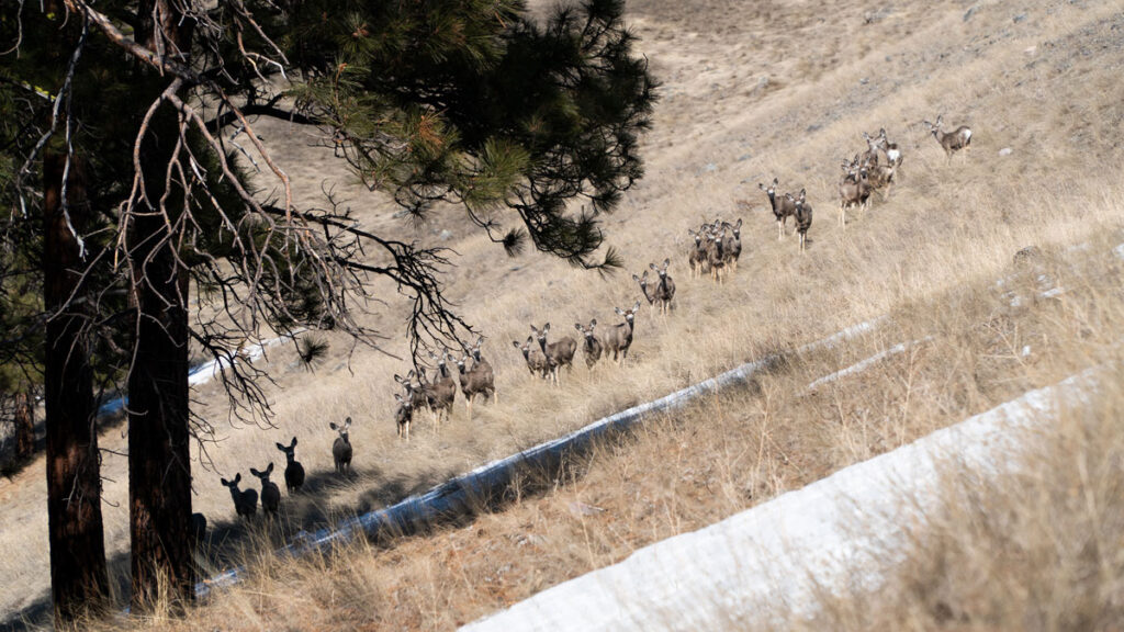
Americans can have both renewable energy and robust wildlife populations, but deliberate steps must be taken now to ensure that future. The preferred alternative in the draft plan (Alternative 3) identifies 22 million acres of your public lands to be made available for solar energy development, including 1.8 million acres of migration corridors and 4 million acres of winter range for some of the West’s most well-known big game herds and hunting destinations. Storied mule deer herds like the Paunsaugunt in Utah, the Kaibab in Arizona, and the Wyoming Range could suffer if this proposal is not modified. 

Mule Deer: James Wicks

Encouragingly, the BLM’s draft plan specifies that only 700,000 acres are necessary to fulfill the agency’s solar deployment objectives. Even if the agency is wrong and solar deployment requires several times the anticipated land, the BLM could still fully meet their targets and exclude all big game crucial winter range and migration corridors from development.

To learn more, read the below state-by-state breakdowns and follow the links to maps that show some of the greatest development threats to big game habitat from utility-scale solar development.  

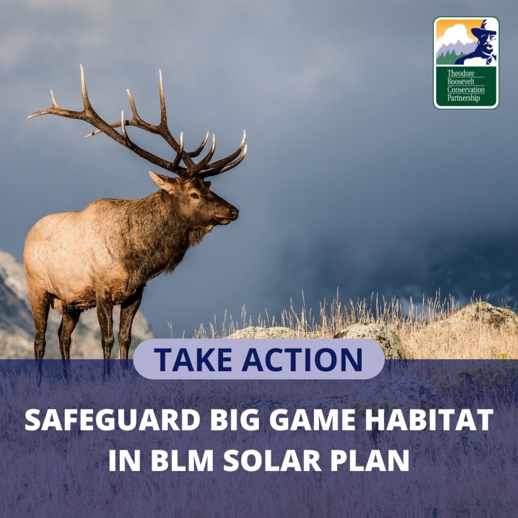
Comment now and request that BLM fix the final Western Solar Plan by excluding crucial big game habitats from potential development.    

This image has an empty alt attribute; its file name is Take-Action-button.png

State-by-State Breakdown

Arizona

The proposed plan would allow for solar development across 2.3 million acres of BLM-managed ground in Arizona. 

However, even the preferred alternative of the plan allows for significant development in mapped mule deer migration and winter range habitat utilized by the Kaibab North mule deer herd, as well as the Paunsaugunt herd that travels south out of Utah to winter in northern Arizona. The Kaibab deer herd offers some of the most sought-after mule deer buck hunting in the world in units 12A and 12B. In 2019, the Kaibab herd had an estimated population of 10,200. The loss of winter range and migration habitats to utility-scale solar development would have extensive impacts on the herd. 


Nevada

The proposed plan would allow for solar development across nearly 7 million acres of BLM-managed ground in Nevada.  

Alternative 3 includes development in several mapped deer migration routes in northeast Nevada, and would also impact mule deer winter range in Management Areas 6, 7, 22, and 24, pronghorn winter ranges in Management Areas 5 and 6, and several important ranges for desert bighorn sheep in Management Areas 21, 26, and 27. 

Importantly, the majority of the development areas are located in winter range and migration corridors—a limiting habitat for these big game populations—the loss of which will have disproportionate adverse impacts. 

The following links provide detailed maps of potentially impacted areas in Winnemucca, Mina-Tonopah, and North Caliente


Oregon

In Oregon, under BLM’s stated preferred alternative, the Solar PEIS has proposed 714,957 acres of BLM-administered lands as open for solar development. While much of those lands do not conflict with priority wildlife habitat, Alternative 3 allows for development that lies within important ungulate winter range and significantly impinges upon the migration pathways of several mule deer, elk, pronghorn, and bighorn sheep herd ranges. 

Oregon Department of Fish and Wildlife’s 2024 Draft Mule Deer Plan identified seven Herd Ranges of High Concern. Oregon’s Crescent, Bulelah-Malhuer, Klamath Basin, and southeast mule deer herds face significant impingements to their migrations and further fragmentation could create significant additional downward pressure on populations in several of Eastern Oregon’s most iconic game management units. 


Idaho

The proposed plan would allow for solar development across a total of 1.47 million acres of BLM-managed ground in Idaho.  

While most of the proposed acres do not conflict with priority big game habitat, Alternative 3 allows for extensive development in four mapped pronghorn and deer migration routes in southcentral and southwest Idaho, including over 9,000 acres in the Pioneer Mountain mule deer migration, which offers some of Idaho’s highest quality buck hunts in units 44 and 45. The potential solar development would also impact the Mountain Home (51,533 acres), Owinza (123,595 acres), and Gooding (27,886 acres) pronghorn migrations.  


New Mexico

According to the proposed plan, nearly 3 million acres of BLM-managed ground in New Mexico would be open to solar development, including significant development in mapped mule deer migration and winter range habitat utilized by the Crow Mesa herd in Game Management Units 2C, 5A, and 6A, as well as winter range habitat for the Pueblo of Santa Ana mule deer herd in Game Management Unit 9.  

Mule deer are an especially important species for the hunting community in New Mexico, as they account for more than 95% of the annual deer harvest across the state. 


Colorado

The proposed plan under Alternative 3 would make 548,225 acres of BLM-managed surface lands open for solar development in Colorado. 

A significant proportion of these acres overlap high-value habitat for important elk, deer, pronghorn, and bighorn sheep herds in western Colorado. The overlap includes elk migration, severe winter range, and winter concentration areas for the Cold Springs elk herd in Colorado’s northwest corner GMUs 2, 10, and 201; as well as mule deer migration, severe winter range, and winter concentration areas for the White River Mule Deer Herd in the Piceance Basin in GMUs 11 and 22. The BLM’s proposal would also make high-value big game habitat available for future solar development in the Uncompahgre area, South Park, and the San Luis Valley.  

Follow the links to view maps of potential overlap in the Dinosaur, Uncompahgre, and Piceance areas as examples of areas at-risk.  


Wyoming

Wyomingites previously saw crucial winter range and migration routes for pronghorn antelope in southwest Wyoming cutoff when the Sweetwater Solar project was completed in late 2018. To avoid similar mistakes in the future, it will be important for the BLM to exclude development in big game winter range, migration corridors officially designated by the state, and additional mapped migration routes. 

The BLM’s proposed plan for solar development in Wyoming includes nearly 3 million acres. Within this proposed area lies an overlap between iconic deer herds like the Sublette mule deer herd as well as the Wyoming Range mule deer herd (region G & H) famous for the Red Desert to Hoback migration route. In addition, proposed solar developments could also interrupt the famous “Path of the Pronghorn” migration route completed by the Sublette pronghorn herd. This migration route is currently in the process of being formally designated by the state due to its significance.  

The BLM’s proposed alternative also would disproportionately impact the Medicine Bow pronghorn herd and the Baggs mule deer herd—a migration route along the Colorado and Wyoming border. 


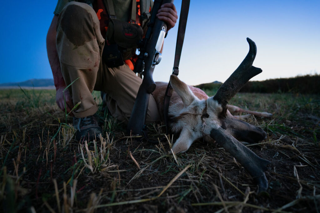
Pronghorn: James Wicks

All people who care about hunting, fishing, and wildlife habitat on public lands, can request these specific modifications to the Bureau of Land Management’s Western Solar Plan below.

Feature Photo Credit: Josh Metten

by:

posted in: Energy

January 22, 2024

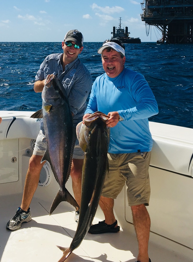
Removing Retired Gulf Rigs Ruins Offshore Fishing

Decades-old offshore oil and gas structures, no longer involved in extraction, still provide critical marine habitat – and bipartisan legislation is aimed at protecting these rigs-turned-reefs

Here in Louisiana, I look forward anxiously to the first weekend in June every year.

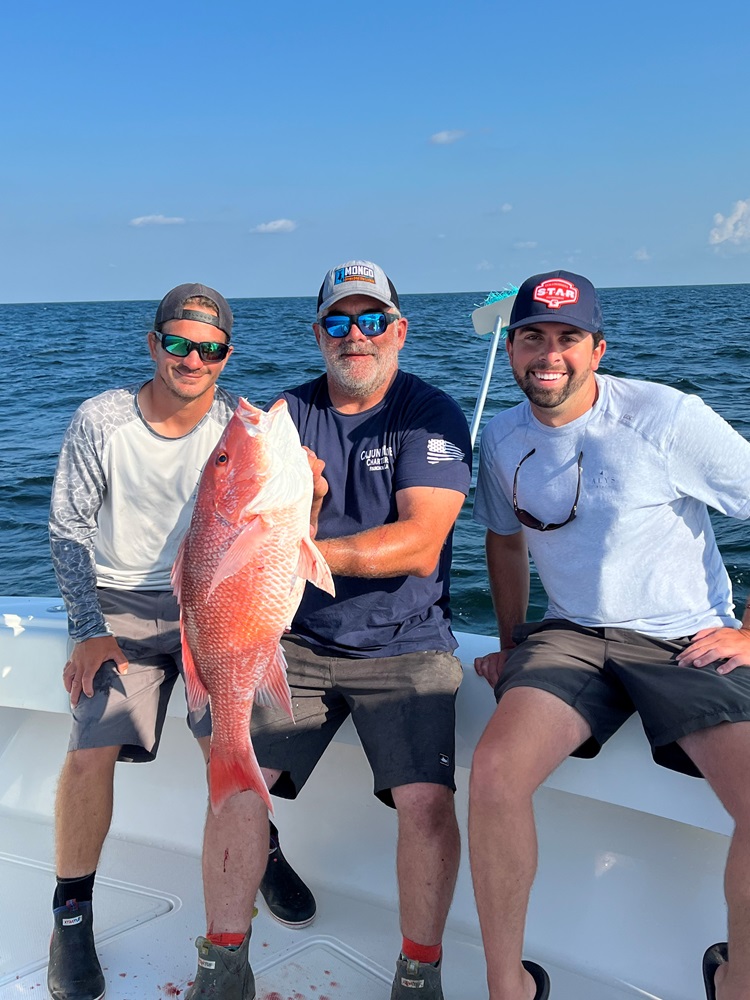
Some good buddies and I always get together to fish our high school’s alumni tournament in Port Fourchon. Weather permitting (and sometimes even when we should have stayed in bed), we snapper fish on the oil and gas rigs and artificial reefs that have come to life on those structures, almost always with incredible success.

Our favorite destination was once the South Timbalier 50’s blocks, specifically the red-and-yellow-painted double platform that towered over the other dozen or so structures in the area. It was about 12 miles southwest of Belle Pass, meaning it was generally accessible in a 24-foot bay boat. It stood in 60 feet of water and always held nice-sized red and mangrove snapper. Six years ago, we aimed the boat right for it on the first day of the tournament, only to find it wasn’t there anymore.

From a marine fisheries standpoint, Gulf rigs provide an extensive network of the world’s most productive artificial reefs.

This has become a common story along the Gulf Coast. In the early 1980s, there were some 4,000 oil, gas, and sulfur production platforms in the northern and western Gulf. Obviously, the metal structures fixed to the sea floor in depths of 3 to 1,300 feet of water were built to extract and transport petroleum and minerals. But from a marine fisheries standpoint, they also quickly became an extensive network of the world’s most productive artificial reefs.

In the last 25 years, that number of rigs has been cut by 60 percent. In the next decade, as many as 700 more of the 1,550 or so remaining rigs could be removed as well. And, when they are removed, federal law currently requires that the sea floor be stripped bare, with all signs of the rig and associated reef removed.

Fortunately, two Gulf Coast congressmen have recently stepped in to try and save some of the ecologically and economically valuable reefs that have colonized the rigs. Rep. Garret Graves, a Louisiana Republican, and Rep. Marc Veasy, a Texas Democrat, introduced H.R. 6814 late last year. Named the “Marine Fisheries Habitat Protection Act,” it would change federal law and policy to require the National Oceanic and Atmospheric Administration to examine the Gulf’s artificial reefs and associated fisheries production while encouraging more participation in the Bureau of Safety and Environmental Enforcement’s Rigs-to-Reefs Program.   

Critics of artificial reefs, and of the oil and gas industry, have long claimed these structures are simply fish aggregators, meaning they make fish easier targets for anglers and commercial harvesters, likening them to piles of corn or salt licks that attract deer. However, research conducted over the last 30-plus years by Texas A&M Corpus Christi, Louisiana State University and a host of other academic institutions have thoroughly debunked those claims. For some fish, especially snappers and groupers, rig reefs are just as productive or more productive than natural hard bottoms and corals. And these vertically oriented structures can host as many as 90 species of fish that utilize different water depths, while steering fishing pressure away from sensitive natural reefs.  

Within weeks of being in the water, rig legs begin to be colonized by benthic creatures like corals, sponges, barnacles, algae, and other organisms. Some fish species also arrive almost immediately, with jacks, dolphin (mahi mahi), sharks, mackerels, barracuda, tunas, and others quickly orienting higher in the water column. Reef fish and crustaceans come soon after with snappers, groupers, spadefish, triggerfish, and numerous other structure-loving fish colonizing the maze of vertical pilings and cross members.

While Atlantic coast and eastern Gulf states seek out decommissioned naval ships, old tugboats, subway cars, and many other hard structures to sink to expand fish and coral habitat and increase fisheries production and opportunity, Louisiana, Texas, Mississippi, and Alabama had artificial reefs built for them free of charge by the oil and gas industry. All four states have worked with the owners of those platforms on programs to keep as many decommissioned structures as possible in the water, but the rate of removal has far outpaced the effort to navigate the web of bureaucracies, laws, and policies allowing them to stay in place.

For Gulf anglers, the removal of their favorite fishing spots has been a punch to the gut. Many are rightly frustrated, and even angry, at the lost fisheries production and opportunity. Reps. Graves and Veasy, both avid anglers, are deserving of praise for trying to do their part to help their constituents and, more importantly, the fish themselves. With your support, hopefully all of Congress sees it that way and gets behind this bill.   

Tell Congress to support legislation to protect artificial reefs and offshore fishing.

by:

posted in: Energy

January 18, 2024

The TRCP applauds BLM Eastern Colorado Resource Management Plan for Establishing Backcountry Conservation Areas

Within BCAs, the BLM will prioritize conservation, restoration, and hunting and angling access

Today, the Bureau of Land Management’s Royal Gorge Field Office published their Record of Decision revising the Eastern Colorado Resource Management Plan after more than eight years of planning and public engagement. Hunters, anglers, and conservationists applaud the addition of 87,400 acres of Backcountry Conservation Areas in the Arkansas River Valley and Rural Foothills landscapes within the field office.

“The Eastern Colorado RMP will improve how high-value fish and wildlife habitat is conserved and managed across these BLM lands,” praised Liz Rose, Colorado field representative for the TRCP. “The BLM is wisely directing development away from key wildlife habitats by excluding BCAs from future utility and non-utility scale renewable energy and oil and gas development, while prioritizing conservation measures that benefit wildlife, hunters, and anglers long-term.”

This final RMP will provide management direction for 658,200 surface acres and nearly 3.3 million acres of BLM-administered mineral estate across eastern Colorado for decades to come. These BLM lands are home to elk, mule deer, pronghorn, bighorn sheep, and wild and native trout, and encompass 487 miles of streams and rivers and popular destination lakes and reservoirs valued by anglers. The TRCP thanks all the BLM, Department of Natural Resources, and Colorado Parks & Wildlife staff, county officials, and TRCP members, supporters, and partners who have provided invaluable feedback, guidance, and expertise since this plan revision process began in 2015.

The final BLM plan commits to managing about 13% of the field office as BCAs. Protecting these extraordinary fish and wildlife habitats from incompatible development and habitat fragmentation, while providing high-quality access for hunting, fishing, and trapping is a win-win for TRCP members. 

In these BCAs, the BLM will focus management activities on the conservation and restoration of key habitats, which can include wildfire mitigation work and habitat improvement projects.

Before the formal planning process began, Park County, Colorado Wildlife Federation, TRCP, several other conservation organizations, and water providers came together as the South Park Coalition and began identifying areas suitable for development and areas key to conserve.

“I think the work we did well before the formal process made a big difference to enable the really good outcome for the unique resources of the South Park area,” said Suzanne O’Neill, executive director of the Colorado Wildlife Federation. “We applaud BLM’s recognition throughout the process of this iconic basin’s distinctive and largely unfragmented wildlife habitats, prized trout streams, water quality, and spectacular vistas. In addition, the plan’s treatment of the areas managed by BLM in eastern Colorado outside of South Park has been much improved.”

The now cohesive, established framework for guiding management on eastern Colorado’s public lands will mean the BLM will be able to adapt management to best address shifting conditions and priorities.

Photo Credit: Larry Lamsa

by:

posted in: Energy

January 17, 2024

TRCP Responds to BLM Western Solar Development Proposal

Organization encourages BLM to conserve big game habitats & hunting and fishing areas as it advances solar development on public lands

Today, the Bureau of Land Management released a draft plan that—when completed—will guide utility-scale solar development on federal public lands across 11 western states. The draft is a proposed update of BLM’s 2012 Western Solar Plan, which identified areas in Arizona, California, Colorado, Nevada, New Mexico, and Utah with high solar potential and low resource conflicts to streamline solar development. The update expands application of the Western Solar Plan to include potential solar development on public lands in Idaho, Montana, Oregon, Washington, and Wyoming.

“We recognize that public lands in the west provide important options to help meet the nation’s renewable energy needs,” said Jon Holst, wildlife & energy senior advisor for the Theodore Roosevelt Conservation Partnership. “Our public lands also contain critical unfragmented habitats for fish and wildlife populations that offer world class hunting and angling opportunities. We will be looking at the details of this draft plan to make sure that the interests of hunters and anglers are incorporated.”

The TRCP and partners have been involved in BLM’s efforts to update the Western Solar Plan since scoping began in late 2022. The updated plan is an important step toward meeting the Administration’s goals of deploying 25 GW of renewable energy on public lands by 2025 and to have a 100 percent clean electricity grid by 2035. The BLM and Department of Energy estimate that approximately 700,000 acres of public lands will be needed to meet the Administration’s goals for solar deployment. The TRCP is committed to working with our membership, partners, state and local governments, and other key stakeholders to facilitate a successful outcome for the Western Solar Plan that advances the development of solar energy in a manner that also conserves our natural resources and sporting heritage.

This release kicks off a 90-day comment period where the public will have an opportunity to provide input on the alternatives and other management options presented by the BLM in the draft plan. Public input will inform a Final Programmatic Environmental Impact Statement and Record of Decision. The public can submit written comments through April 18, 2024. More details are available on BLM’s Solar Program website.

Find the BLM press release here.

Find TRCP’s scoping comments here.

Find TRCP’s public land solar blog here.

HOW YOU CAN HELP

TRCP has partnered with Afuera Coffee Co. to further our commitment to conservation. $4 from each bag is donated to the TRCP, to help continue our efforts of safeguarding critical habitats, productive hunting grounds, and favorite fishing holes for future generations.

Learn More
Subscribe

You have Successfully Subscribed!

You have Successfully Subscribed!

You have Successfully Subscribed!

You have Successfully Subscribed!

You have Successfully Subscribed!